
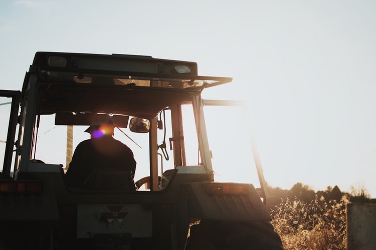
Increasing yield and improving efficiency in agricultural production are the fundamental goals. To achieve the goal of increasing yield and efficiency, in addition to technical measures such as timely planting of high-yield crops and strengthening field management, clarification of soil properties, inspection of crop yield, distribution, rational fertilization, and planting and spraying of pesticides are also important management techniques in agricultural production. In particular, as modern agricultural production is moving toward large-scale agriculture and mechanization, a large number of aircraft broadcast and sprays are used. In order to reduce investment costs, it is also very important to guide aircraft operations to accurately deliver. Using GPS technology, combined with remote sensing technology (RS) and geographic information system (GIS), it can monitor crop yield distribution, soil composition and property distribution, and achieve reasonable fertilization, sowing and spraying of pesticides, saving costs, reducing costs, and increasing The purpose of productivity improvement. Using differential GPS technology can do:
1.1 Investigation of soil nutrient distribution
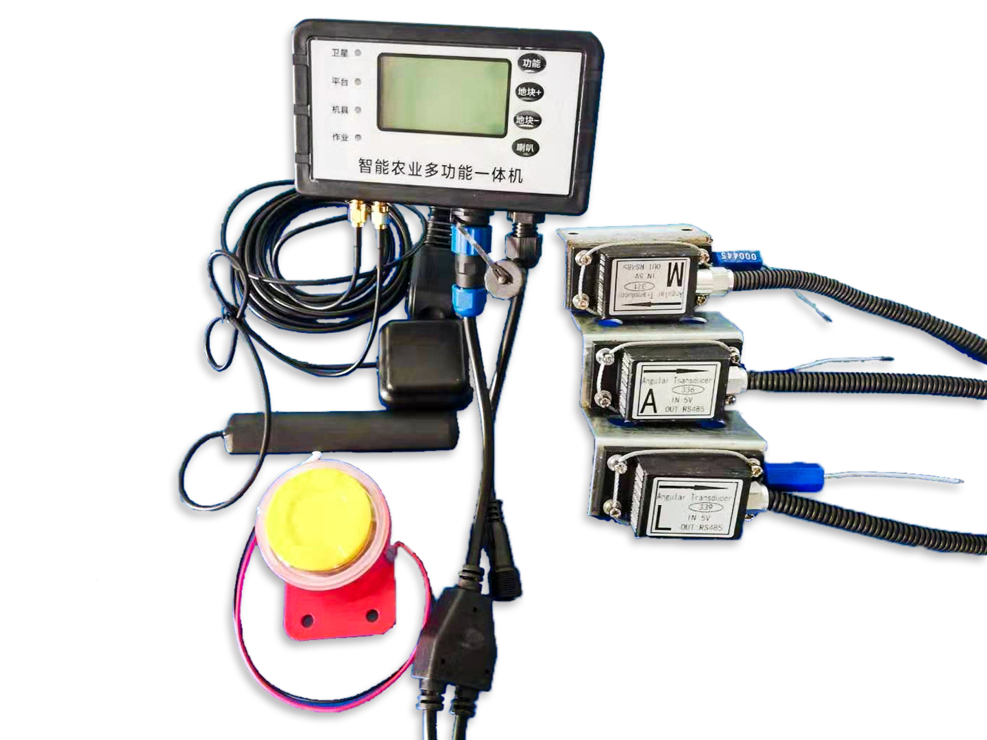
Before sowing, a sampling vehicle suitable for operation in farmland can be used to collect soil samples in farmland according to certain requirements. The vehicle is equipped with a GPS receiver and a computer, and the computer is equipped with geographic information system software. When collecting samples, the GPS receiver accurately determines the location of the sample collection point and inputs it into the computer. The computer calibrates the sampling point according to the geographic information system and draws a map of the location of the soil sample.
Configure a computer, output monitor and GPS receiver on the combine harvester to form a crop output monitoring system. Different monitors are required for different crops. For example, a monitor that monitors corn yield. When corn is harvested, the monitor records the number of scion and yield of corn. At the same time, the GPS receiver records where the corn is harvested, and finally draws a picture about the yield of each piece of land through the computer. The production distribution map. Through the comprehensive analysis with the soil nutrient content distribution map, it is possible to find out the relevant factors affecting crop yields, so as to carry out specific field fertilization and other management tasks.
1.3 Reasonable fertilization, precision agricultural management
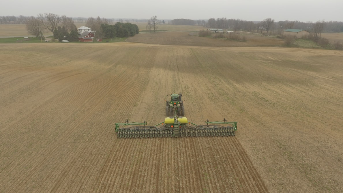
According to the distribution map of soil nutrient content in farmland, the sprayer of “controlled application” with GPS receiver is set up. Under the control of GPS, according to the distribution map of soil nutrient content, it can accurately fertilize various points in the field and apply fertilizer The type and quantity are controlled by the computer according to the nutrient content distribution map. In the management of crop growth period, the use of remote sensing images combined with GPS can draw crop color changes. Using GPS positioning to collect a certain number of soil and crop samples for analysis, can draw a series of distribution maps of soil content in different periods of crop growth. In this way, the crop growth can be managed accurately. The use of airplanes for planting, fertilizing, and weeding is expensive. Arranging routes reasonably and guiding the aircraft accurately will greatly save the cost of aircraft operations. According to foreign reports, using differential GPS to accurately navigate aircraft is estimated to reduce investment by 50%. In specific applications, the use of GPS differential positioning technology can reduce the horizontal overlap when spraying fertilizers and herbicides, save the amount of fertilizers and herbicides, and avoid excessive amounts that affect crop growth. It can also reduce turning overlap, avoid waste and save resources. For spraying at night, it has more advantages. Because the evaporation and drift loss at night are small, and the stomata of plants are opened at night, it is easier to absorb herbicides and fertilizers, and improve the efficiency of weeding and fertilization. Relying on differential GPS for precise navigation and guiding agricultural machinery for night spraying and field operations can save a lot of pesticides and fertilizers. The application of GPS technology in the agricultural field is not only for large-area planting, but also for small-scale farmland, especially in the small area of grid planting, using small automation equipment, with differential GPS navigation equipment, electronic monitoring and control circuits, and it can be adapted to The needs of scientific farming are managed precisely. This kind of investment is low, installation is convenient, and operation is flexible.
In short, GPS technology will play an important role in the agricultural field. In our country, it is still necessary to actively carry out application research in agriculture and the development of related equipment. Especially in the Great Plains, areas that utilize large-scale mechanized production should pay attention to the application of GPS technology in farmland operations and management. Application of GPS in locust control and wheat rust control.
Application of positioning function
Through the comprehensive application of GPS and GIS two advanced technologies in the survey work, it is expected to accurately delineate the locust prone areas and the accurate location, topography and landforms of wheat rust, so as to provide accurate pesticide application during aircraft and manual control, efficient prevention and control, and reduce environmental pollution. Scientific basis, so that the aircraft control of locusts and other tasks completely get rid of the history of relying on artificial ground signals. Since locusts are migratory pests, for their migratory paths, the real-time GPS position return function can provide timely and accurate data for determining their migratory paths and scientific comprehensive control.
Application of area measurement function
Through the combination of GPS and GIS, the locust disaster area or the area of wheat rust disease can be accurately measured, providing a scientific basis for reasonable spraying, and playing an important role in the scientific management of disaster assessment and pest control forecasting.
Post time: Sep-25-2020