
Applying GPS technology to agricultural fields and agricultural machinery can effectively improve the level of agricultural production and agricultural machinery operations. It expounds the composition of GPS and differential GPS technology, analyzes the specific application of GPS in modern agriculture and agricultural machinery, in order to provide reference for the application of GPS technology in modern agriculture in my country.
The management of crop growth and material placement in traditional agriculture in my country is largely based on experience, while modern agriculture requires precise operations to manage different fields and crops separately, and carry out field management and material placement based on the growth characteristics of crops in the field and soil conditions , Management effectiveness and accuracy of material delivery have been greatly improved. In order to facilitate the management of farmland operations, a positioning system is required to accurately locate and record geographic locations. The use of global positioning system for data collection and the use of modern information technology for navigation on this basis can provide effective help for farmers to accurately grasp the location of agricultural machinery such as tractors and harvesters and farmland equipment, and greatly improve the accuracy of agricultural production. It is an important application of GPS technology in modern agriculture
1 The composition of GPS
GPS refers to the Global Positioning System. Its principle is to use navigation satellites to detect and locate objects on the ground. GPS is composed of three main parts: ground monitoring, space constellation, and user reception. Ground monitoring is subdivided into three parts: injection station, monitoring station, and main control station. The injection station is responsible for injecting detailed satellite data;
Responsible for monitoring the real-time information of satellites, and at the same time compiling ephemeris; the master control station revises various parameters in time. These three parts realize the interconnection of information with the help of modern communication technology, and can exchange various data in real time. The operation and control of the three stations are all built on the basis of computers and atomic clocks, which can realize the automation and precision of the operation process. The space constellation has 24 satellites, of which 3 are spare satellites. The 24 satellites are equipped with high-precision atomic clocks. Atomic clocks play a vital role in satellites and are an important basis for ultra-high-precision time control. . The satellites in the space constellation operate evenly distributed in six orbits, and the orbital time is about 11 h58 min, which provides a comprehensive guarantee for satellite observations at all locations and times on the earth. In addition, the weather will not affect the reception and propagation of satellite signals, thus achieving global, all-time real-time positioning. The user receiving part is to accurately receive the signals transmitted by the satellite through the GPS receiver, and use the received data to observe and process the data to complete the navigation and positioning service. Simply put, it is to track the various data of the satellite, and then process and amplify the obtained signal to obtain the GPS signal. The time it takes to propagate from the satellite to the receiving antenna is calculated based on the navigation messages generated by the GPS satellite. Translation processing, and then get the three-dimensional speed, time and position of the station. From the current international market, there are many manufacturers of GPS receivers. The structure of the GPS receiver can be roughly divided into two parts, namely the receiving unit and the antenna unit,
The receiving unit is composed of power supply, storage unit, channel unit, calculation and display control unit, etc. The antenna unit is composed of preamplifier and receiving antenna.
2Differential GPS technology
Differential GPS technology is developed through GPS technology and differential technology. This technology allows GPS to obtain more accurate data to meet the needs of higher-level users. Place the GPS receiver in a place where there is a precise location to form a reference station. Once the reference station receiver receives the visible satellite information, it will measure the pseudorange of the satellite based on the information and compare the pseudorange with the archived precise distance. In this way, the position measurement error of the visible satellite information in the GPS system is obtained. This error is also called the difference correction distance. Then use this error as the correction value to compare with the standard data and transmit to the space launching station, so that the GPS system of each user in the nearby area receives the error correction signal from the calculation, thereby correcting the GPS measurement value inside the positioning system and improving the positioning accuracy . Differential GPS positioning will be distinguished according to the difference in the way the base station sends information, including carrier phase difference, pseudorange difference, position difference, and phase smooth pseudorange difference. At present, these several differential technologies have been used in various agricultural production technologies to provide more precise data for the precise positioning of modern agriculture.
3 Application of GPS in modern agriculture
The ultimate goal of the development of modern agriculture is to increase the yield and economic benefits of crops, and improve the farmland planting environment. In order to effectively achieve this goal, it is not only necessary to conduct research and introduction of high-quality and high-yield new varieties, adjust agricultural production structure, strengthen field crop management, formulate scientific fertilization strategies, etc., but also plan agricultural resources from the perspective of scientific development and conduct systematic Effective deployment and management can achieve comprehensive development and utilization of resources, effectively improve resource utilization and sustainable development benefits, and help increase agricultural production revenue and efficiency. Therefore, it is necessary to accurately and timely obtain and utilize the various resource information of modern agriculture.
3.1 Applied to the production of farmland electronic maps
In order to apply and improve precision agriculture technology, an electronic map of farmland is made according to the cultivated farmland. According to the function of the GPS receiving equipment, farmers can walk around the farmland in a circle, thus realizing the limitation of the position of the farmland boundary. In order to keep the various parameters of the farmland consistent with the actual information of the farmland, farmers must update and investigate the crop growth situation, soil nutrient distribution, soil erosion and operation status in the farmland in a timely manner. The GPS system is used to improve the areas with large changes in the topography of the farmland, so as to achieve accurate recording and satellite positioning.
It also includes important factors such as roads, reservoirs, houses, ditches, etc. distributed in the farmland, which are accurately displayed on the farmland electronic map. After recording the various data on the farmland, use the downloaded and recorded farmland boundary and topographic data, and apply relevant software to make a farmland electronic map for later use.
3.2 Applied to accurate investigation of soil nutrients
Through soil sampling, the distribution of soil nutrients can be obtained, which provides a basis for scientific fertilization and maximizes the efficiency of fertilizer use. Soil sampling can be carried out using GPS and related sampling software. According to the measurement requirements, the GPS sampler is used to collect soil samples in farmland. The positioning of each sample point can be completed by differential GPS technology. Then, according to the nutrient content in the sample and the topographic map of the survey area, combined with GIS technology, the soil in the area The nutrient content distribution map is drawn to provide a reliable basis for farmers to scientifically fertilize and rationally arrange crop planting. During the crop growth period, GPS positioning can also be used to collect data, and the soil samples and crop samples of the farmland can be compared and analyzed, and the growth of crops in different periods and the nutrient content of the soil in different periods can be mapped through GPS technology and RS technology. The map is drawn to realize modern agricultural production with scientific management and precise regulation.
3.3 Applied to modern agricultural machinery
The application of GPS technology in modern precision agriculture is for precise positioning, topographic measurement and navigation of various farmland operations. In order to achieve these goals, GPS receivers should be closely linked with farmland machinery to achieve precise positioning, topographical measurement and automatic navigation of farmland in various farmland operations.
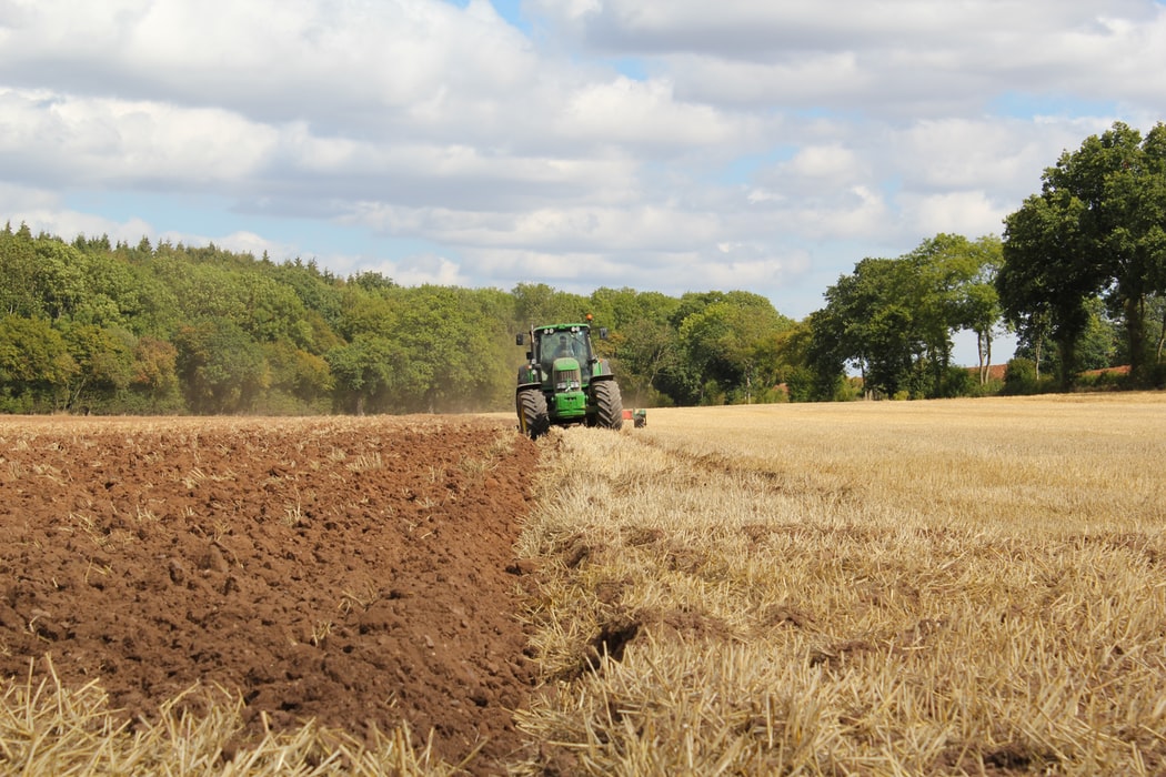
(1) Applied to unmanned tractors. Unmanned tractors use GPS and near-ground systems to navigate farmland operations using unmanned technology. Unmanned tractors can liberate farmer labor, do not require driver operations, and can perform fine operations continuously for 24 hours. The internal space can also be used for installation of agricultural tools, which improves the work efficiency of the overall unit.
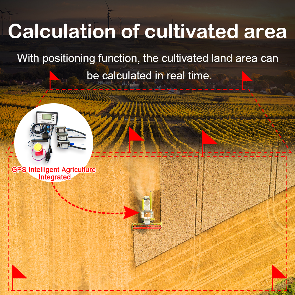
(2) Applied to combine harvesters. This type of harvester is equipped with a global positioning system receiver and a geographic information system. When crops are harvested, the yield sensor and DGPS technology can obtain the distribution data of the output of each crop in the farmland, and enter these data into the computer to make the output distribution Figure; Then input the factors that affect crop yields into the computer for comparison, analyze the specific reasons for the differences in yields, and take corresponding measures to solve them, so as to achieve the purpose of increasing field crop yields. In addition, the intelligent control software of agricultural machinery can be used to increase crop yields according to actual needs, such as planting machinery, plant protection machinery, fertilizing machinery, etc.; each year, the new year’s field crop planting plan is formulated through the comparison of output data. Achieve the modern agricultural planting goal of fine planting.
(3) Applied to variable fertilization. Fertilization is carried out according to the demand of the crops, and the automatic variable fertilizer applicator is used to complete. First, the GPS receiver is used to delimit the crop planting area and obtain the contour data of the crop planting area. The data is entered into the computer to make an electronic map, and then the data is processed by the geographic information system to investigate the area of the farmland. Soil nutrient information and production database. Secondly, enter the data and decision data of the working plot in the control system of the variable fertilizer applicator, let the fertilizer applicator carry out fertilization operations inside the farmland, and use the GPS receiver to receive various positioning data from the satellite to judge the fertilizer decision of each farmland operation unit Information, control the fertilization of the fertilizer applicator, and achieve the purpose of automatically adjusting fertilization to the corresponding soil.
(4) Applied to the investigation of plant diseases and insect pests. The occurrence of diseases and insect pests is characterized by short transmission time and large spread area, which is extremely harmful to crops. Use GPS technology to collect relevant information about the areas where pests and diseases occur, and upload them to the pest control department via the Internet for decision-making. According to the actual information collected by GPS technology, the prevention and control department can draw out the spreading route and area and spreading trend of the pests in the computer, so as to formulate relevant prevention and control measures based on this information to reduce the economic losses caused by the pests to farmland cultivation.
4 Conclusion
In modern agricultural production, the application of GPS technology is conducive to the development and expansion of the advantages of precision agriculture, and can ensure that agriculture achieves the goals of high efficiency, low consumption and environmental protection. This is also the main trend of current agricultural development.
Post time: Sep-25-2020